
Branson, Missouri is widely known for its family-friendly tourism attractions and proximity to several lakes. Nestled in the hills of the Ozark Mountains, it’s home to lots of varying terrain, tons of foliage, millions of trees, and plenty of wildlife – making it a perfect environment for hiking. Hiking in Branson, MO is breathtaking, rewarding, and only a short trip away from many of the area’s most popular hotels and resorts, so you can go hiking near Branson, MO on a short day trip and be back in time for dinner and a show.
We’ll cover the best hiking in Branson in today’s guide so you know what trails to hit on your next trip.
There’s 50 hiking trails in and around Branson, so every hiker has plenty of options to choose from!
The 50 Best Hiking Trails In Branson MO
The Branson area boasts more than 200 miles of publicly accessible hiking trails, so you’ll have plenty of options for simple day hikes or something more challenging on your getaway.
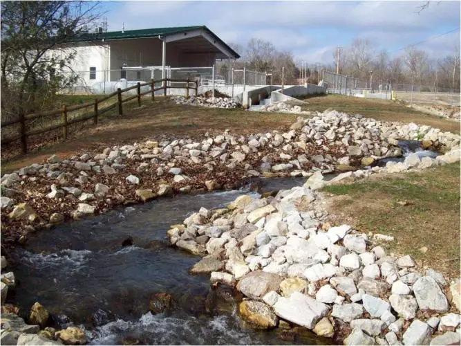
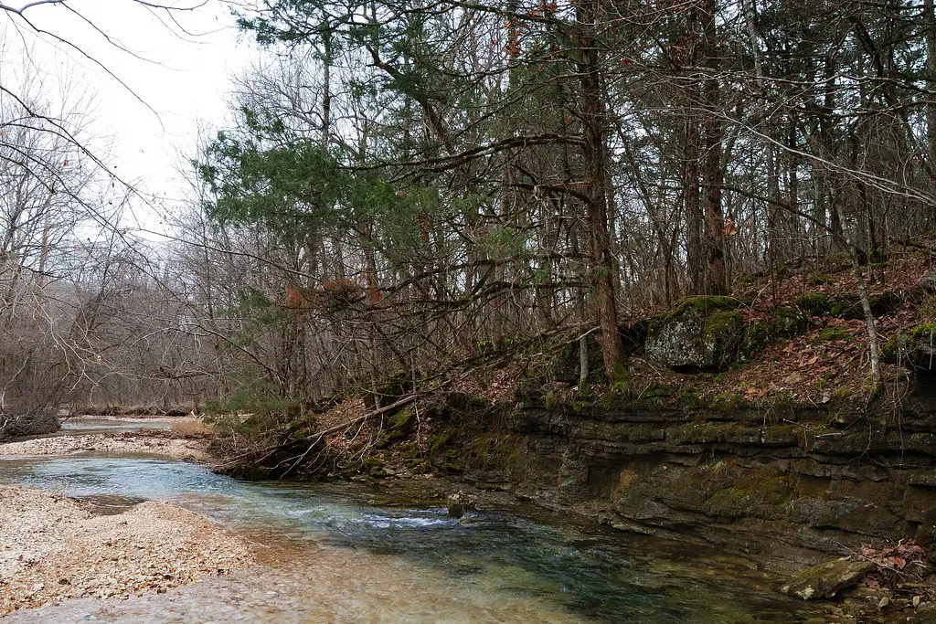
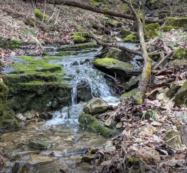
Roark Creek Waterfall Trail (Branson, MO)
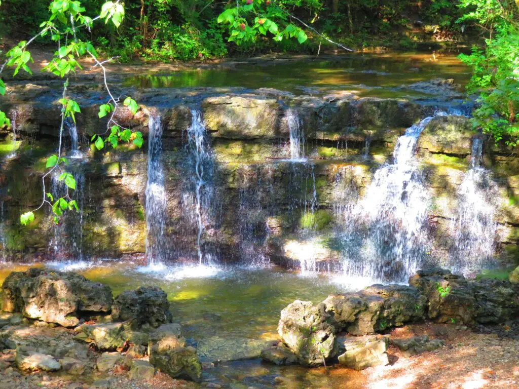
The Roark Creek Waterfall Trail is just minutes off the Branson strip and is a simple, out-and-back 1.8 mile trail that features a beautiful waterfall which is great for some pictures to take home with you.
This is a quick hike that will take less than an hour and should definitely be tried by everyone.
Ruth And Paul Henning Conservation Area (Branson, MO)
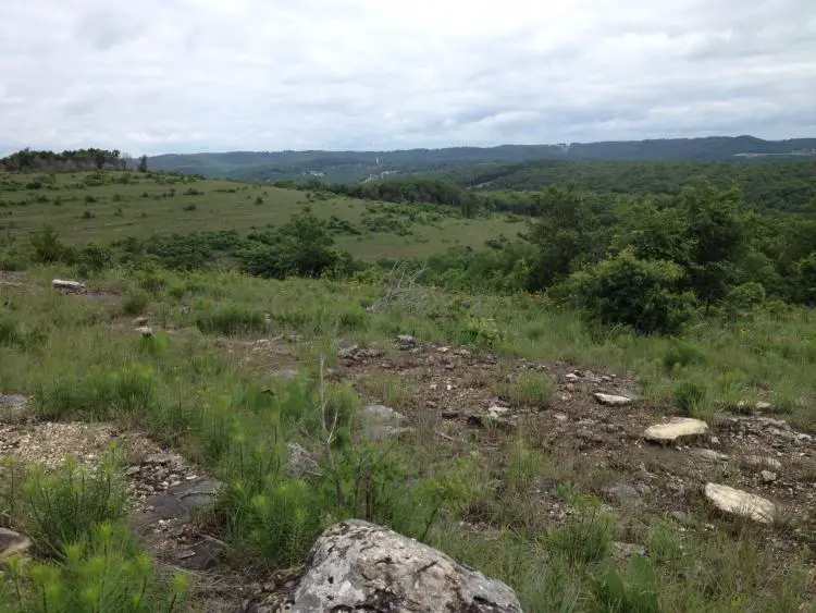
The Ruth and Paul Henning Conservation area is on the west side of Branson in the White River Hills.
This area also includes a small section of bottomland forest along a 0.5mi stretch of Roark Creek, and shows many of the areas glades (also referred to as balds).
The Henning Conservation area features several fantastic trails:
The Glade Exploration Trail
The Glade Trail (1.1mi), takes one hour to complete and features an overlook deck with an optional 0.4mi loop off of the trail called the Streamside Trail.
The Henning Homestead Trail
The Henning Homestead Trail loop trail (3.4mi), taking visitors past the remains of several homestead sites on the north side of the area.
Dewey Bald Lookout Trail
0.4mi long asphalt trail that features a 40-foot viewing tower atop Dewey Bald.
Shane’s Shortcut
Shane’s Shortcut is a 0.3 mile connecting trail between the Homesteader’s Trail and Streamside Trail.
Table Rock State Park (Branson, MO)
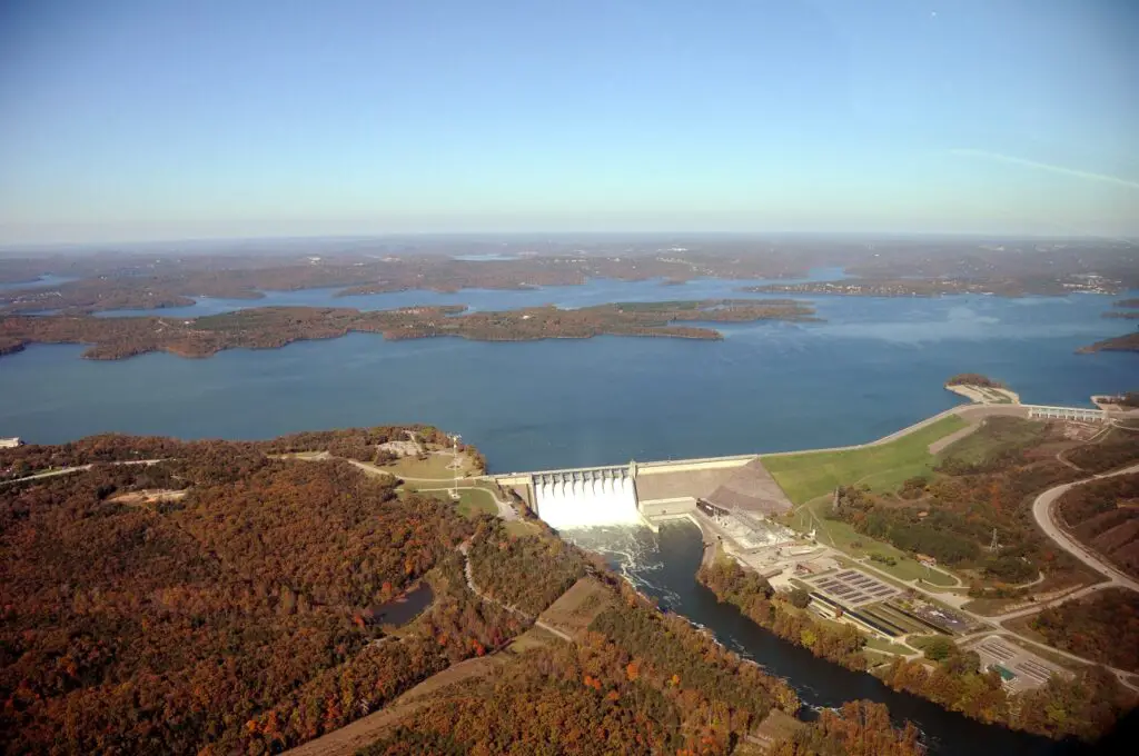
Table Rock State Park is in Branson proper and offers dozens of activities for everyone to enjoy.
The hiking trails in Table Rock State Park include:
Chinquapin Trail
Chinquapin Trail is a 1.2mi natural surface trail that includes access to several points in the park. This trail is relatively flat and takes you through both Ozark woodlands and glades and near rare and endangered wildflowers.
Table Rock Lakeshore Trail
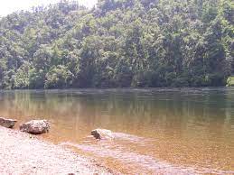
This is a paved flat trail which runs along the shore of Table Rock Lake that is wheelchair and walker accessible. You can often see ospreys, bald eagles, and loons on this trail in the winter.
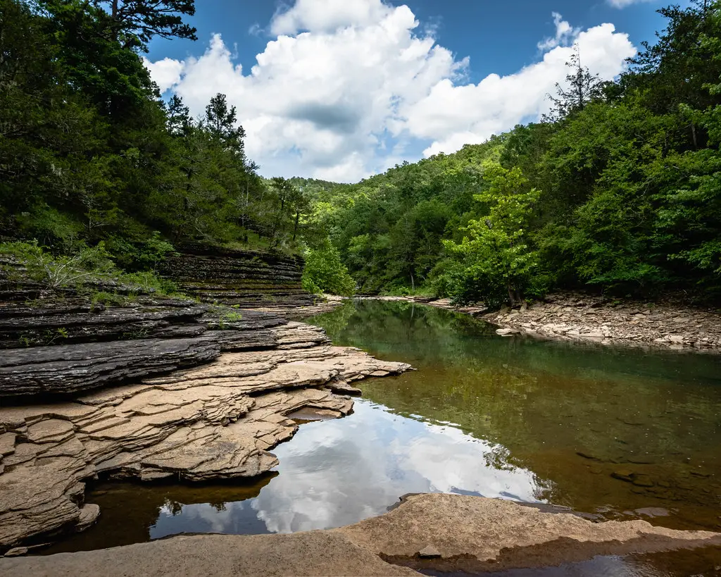
The White River Valley Trail System
The White River Valley Trail System provides rugged and challenging hiking and mountain biking trails totaling 11.3 miles over 4 loops among scenic backdrops. You’ll see waterfalls, views of Lake Taneycomo and Table Rock Lake, and an abandoned farmstead on your hikes here.
The elevations range from 710ft to almost 1,200ft above sea level, and tons of different animals like blue herons all the way to desert-adapted species like roadrunners, lizards, and tarantulas.
Lakeside Forest Wilderness Area (Branson, MO)
The Lakeside Wilderness Hiking Trails are in an 140-acre spot in the heart of Branson that features over 5.3 miles of trails:
Stonewall Trail
Stonewall trail is an easy, ⅓ mile trail that circles the property where Dr. Owen, the original owner of the property built his home, running along stone walls and ending with a view of the White River Valley and Lake Taneycomo from the Bluff Gardens.
Owen Drive Trail
This 0.4 mile trail is wide and level and leads hikers straight to the Owen homestead and meets up at the Ridge Trail, leading travelers past stone walls.
Bluff Trail
Bluff trail is a half-mile path that takes you through upland forest through mature trees and covers some fairly steep terrain, making for a short but interesting hike.
Ridge Trail
Ridge Trail is Lakeside Forest Wilderness Area’s longest trail at 2.4 miles, and makes its way through glades and forests for a nice variety of scenery. It is rated easy to moderate, so it’s good for the whole family.
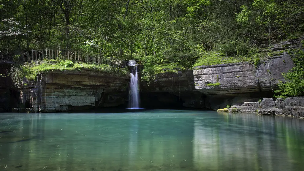
Lake Taneycomo Trail
This 1.06 mile trail is more difficult and covers rougher terrain right alongside Lake Taneycomo, so there’s some incredible views and photo ops.
Make sure to stop and see the grotto, a rock cutout which forms a beautiful waterfall during the rainy season, along with two caves.
Shepherd Of The Hills Fish Hatchery Trails (Branson, MO)
The Shepherd Of The Hills Fish Hatchery is located in the middle of Branson and offers some really cool activities besides just hiking, including a rarely-seen view of the dam, fish feeding, and guided tours, so it’s a great place to go hiking in Branson but also do some other things while you’re there.
White River Bluffs Trail
This trail takes you along the bluffs of the White River for some excellent views, and can be done in a 0.6 mile short loop or 1.6 mile long loop.
White River Corridor Trail
This 0.4 mile one-way trail goes along Lake Taneycomo for some great wildlife viewing.
Canebrake Trail
This 0.3 mile one-way trail leads you from the break area where the White River Corridor Trail ends to the Fisherman’s Trail loop.
Fisherman’s Trail
This 0.4 mile trail is near the fishing area just East of the dam and fish hatchery where you can see anglers vying to get the daily catch.
Hiking Near Branson, MO
Dogwood Canyon Nature Park (Lampe, MO)
Dogwood Canyon is a 10,000 acre outdoor nature area that’s about 26 miles or 35 minutes southwest of Branson in Lampe, MO, founded by Bass Pro Shops CEO Johnny Morris
Dogwood Canyon requires paid admission, but has tons of great things to see and do – including hiking, horseback riding, bike trails, fishing, and even segway tours, all offered with a unique beautiful backdrop of the scenery in Dogwood Canyon.
The hiking trails include 9 miles of nature trails and 6.5 miles of paved paths.
Piney Creek Wilderness Area (Shell Knob, MO)
Piney Creek Wilderness area is about an hour west of Branson and features a total of 13.1 rugged miles of wilderness trails, nestled in over 8,000 acres of Ozark mountains.
The major east-west trail follows Piney Creek for about 4 miles, and there are ridgetops that rise over 400 feet above the hollows and drainages in the area, with tons of waterlife like armadillos, rattlers, and more.
There are no water refill options other than natural water and the trails are challenging, so make sure to carry plenty of water while hiking and come prepared.
Hemmed-In Hollow Trail (Compton, AR)
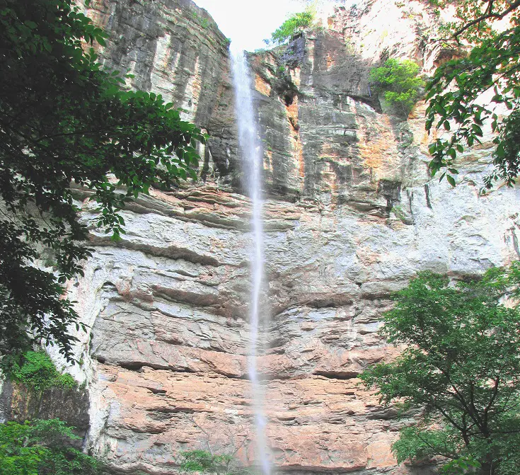
Hemmed In Hollow trail is a out-and-back, 5.7 mile trail located about an hour south of Branson over the Arkansas state line that is a difficult trail that rewards you at the finish with a breathtaking waterfall.
Busiek State Forest and Wildlife Area (Highlandville, MO)
About 20 minutes North of Branson in Highlandville, MO you’ll find Busiek State Forest and Wildlife Area, 2,700 acre wildlife area that has over 18 miles of hiking trails, horse trails, and mountain biking trails.
There’s the 2.95 mile Red Trail, 4.1 mile Yellow Trail, 2.58 mile Silver Trail, 3.82 mile Purple Trail, 2.2 mile Orange Trail, and 4.55 mile White Trail.
All trails have several hundred feet of elevation changes and most are considered challenging trails with steep terrain.
Drury-Mincy Conservation Area (Kirbyville, MO)
For a short trip hiking near Branson, MO head 25 minutes Southeast and you’ll find Drury-Mincy Conservation Area that has a 1.5 mile out-and-back trail that features a cave and is easy enough for hikers of all skill levels.
Hercules Glades Wilderness Trails (Bradleyville, MO)
Located just 40 minutes East of Branson, The Hercules Glades Wilderness Area is over 12,000 acres of the most scenic and unique country in the Midwest, featuring open grassland, forest knobs, rocky steep hillsides, and narrow drainages.
There’s tons of wildlife to see from the regular (like deer, raccoons, songbirds, and lizards) to the rare (such as roadrunners, wild hogs, tarantulas, and black bears).
From the trailheads, there’s 32 full miles of maintained trails which take you through the most incredible scenery, and they allow cross-country hiking which is nice.
These trails are rated as more difficult to most difficult with stream crossings, steep terrain, sparsely marked trails, and elevations ranging from 600 to 1200 feet.
Trails include the Blair Ridge, Middle Trail, Coy Bald, Lower Pilot, Upper Pilot, Long Creek, Pees Hollow, and Tower Trail.
Branson Creek Trails (Hollister, MO)
Located in Hollister, MO near Top Of The Rock and Big Cedar Lodge is The Branson Creek Trails, which are within the Communities at Branson Creek, a private residential development who generously open their trails to public use.
There’s some really cool and interesting trails to see here, including:
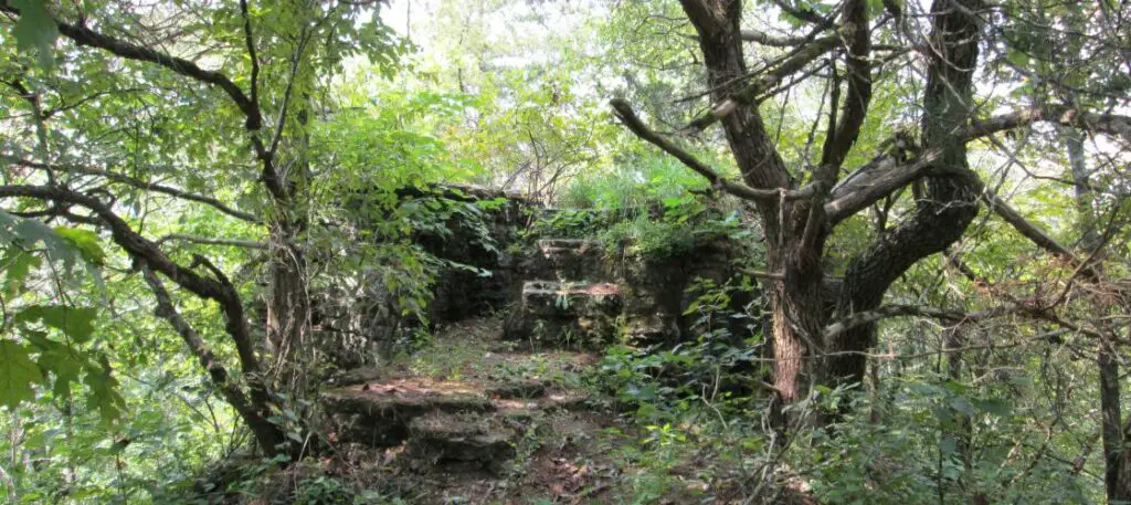
Schoolhouse Loop
This 0.2 mile simple trail leads to the ruins of an old, one-room schoolhouse.
Ridge Run
This 7/10 mile trail is a little more challenging and offers sweeping views of the hill country to the East and North.
Twisted Creek
The ½ mile Twisted Creek trail follows a stream through quiet Cedar stands and offers great views of the hillside.
Miner Valley Trail
This more challenging ⅖ mile trail is a scenic tour of the woods and is great for seeing area wildlife.
Silver Moon Trail
This 0.5 mile hiking and biking trail takes you to the ruins of the Silver Moon Mine, an abandoned mining operation which is really awesome to see in person.
Melva Trail
This 4 mile trail is flat and easy, but long – the reward is great though, as it will lead you to the ruins of the old Melva township that existed back in the 1920’s, and you’ll get to cross two streams and go through some cedar glades to get there.
Cedar Trail
The 1 mile Cedar Trail is great for watching wildlife as it runs along a creek, and there’s a rest area with picnic tables at the halfway point, making it a great choice for families.
King Solomon Mine Trail
This ½ mile trail takes to you to yet another abandoned mining site, complete with mine shafts, structural ruins, and two caves. Very cool sightseeing, and a relatively easy hike.
Murder Rock Trail
The historic and spooky Murder Rock Trailis a 2.5mi rocky dirt trail that winds through a rural area and gets its name from the rock where notorious robber Alf Bolin and his gang used to hide to rob people (and worse) around the time of the Civil War.
Bull Shoals White River State Park Hiking Trails (Lakeview, AR)
Bull Shoals Hiking Trails are located in Bull Shoals White River State Park about 90 minutes Southeast of Branson.
There’s tons to do here including fishing, camping, and 5 hiking trails that are close to both Bull Shoals Lake and the White River.
Big Bluff Trail
This 1.75 mile loop trail is moderately difficult, crossing stream and going through Cedar glades, and is great for seeing colorful Ozark wildflowers.
Lakeside Trail
True to it’s name, the 1 mile easy Lakeside Trail takes you near the South shore of Bull Shoals Lake and is great for seeing bald eagles and gulls in winter and over 90 species of songbirds in summer.
Heritage And Habitat Trail
This ½ mile trail is a relatively easy trail that runs along a previous road that was used to construct the dam.
Gaston Wildflower Garden Area Trail
This paved ¾ mile trail is simple and flat and allows viewing of wildflowers, butterflies, and low wetlands for lots of variety.
FAQs About Hiking In Branson MO
There are 50 options on this list, and all have varying degrees of difficulty, length, and views or sightseeing options.
For a short hike in the heart of Branson, try the Roark Creek Waterfall Trail, hiking on the several trails at Ruth And Paul Henning Conservation Area, Table Rock State Park’s trails, or Shepherd Of The Hills Fish Hatchery’s hiking trails.
The best Branson hiking trails with waterfalls include the Roark Creek Waterfall Trail, The White River Valley Trail System, Lakeside Forest Wilderness Area’s Lake Taneycomo Trail, and Hemmed-In Hollow Trail.
Dog friendly hiking trails in Branson MO include the trails at Table Rock State Park and Ruth and Paul Henning Conservation Area’s trails. Both trail systems require pets to be on a leash.